 |
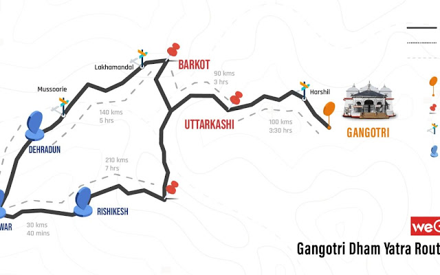
| The Route map of Gangotri |
The climb of the bus from Lanka to Bharionghati was a steep one and we could feel that the engine was under tremendous strain. We had been driving for more than six hours, since we had left Hanumanchatti and come to Dharasu. The scenic views of the lush green mountains with an occasional glimpse of the snow-clad peaks were soothing to the eyes. There was virtually no traffic except for an occasional bus, or a taxi. We had passed the little townships of Netala, Purali and some more before we reached Harsil. Harsil resembles Switzerland in many ways with deep ravines, meadows and beautiful snow-covered Himalayas at a distance. We instantly made up our minds to stop over at the place on return, without knowing much about the place.
 |
| The holy shrine at Gangotri |
As we were excited to reach the destination, a short distance away, the bus was filled with smoke. The driver tried to halt but the smoke became unbearable. Then someone lifted the bonnet and pulled out the wire connecting the battery and there was a flash. Luckily there was no fire, but the engine had become unbearably hot and despite the warning from the radiator temperature indicator, the driver had apparently ignored it. We waited for over an hour till the engine cooled down and the radiator was filled with water from a nearby stream, to continue the last leg of the journey.
 |
| On the trek to Gaumukh, the temple cave visible at a distance |
A little shaken we arrived at Gangotri township, as the sun was about to set. Thankfully we did not have to do any trek and found a place for the overnight stay. Gangotri looked very serene ensconced with mountains all around. We slept off after dinner and the next day woke up to the beautiful sight of a long trail heading to Gaumukh, the origin of River Ganga. The deep gurgling sound of the river Ganga flowing very close was melody to the ears. The water was so clear that we could see the stones and pebbles under the clear stream. After a quick change, we headed to the beautiful temple of Gangotri to offer our prayers. According to mythology King Bhagirath an ancestor of Lord Rama had worshipped Lord Shiva at this spot for a long time before he agreed to bring River Ganga on his hair from the heaven, to reduce the impact of fall. The river Ganga is also called Bhagirithi for this reason. A temple was built in the eighteenth century at this spot.
After visiting the temple we sat by the side of the river and
then decided to climb the trail leading to Gaumukh.
It was a long 17 km trek and after about six kilometres of climb, we could sight
Gaumakh at a great height of 3400 m. The trek was difficult and tiring, so we decided to
turn back. It was a rewarding day as we had seen a lot in the last 24 hours. Later in the evening we spent some time admiring the beauty of
the river and the temple till it got cold and the winds became stronger.
 |
| A view of the Himalayas from Harsil |
The next morning we left by bus for Harsil which was about 25 km away. In less than two hours we reached the small town with hardly any people and a few shops. After checking out, I came across Garwhal Scouts ( An Army unit). The Officer in charge was kind to accommodate us in the Officer's Mess there. It was a beautiful place with breathtaking views all around. While exploring the place we were caught amidst a flock of hundreds of sheep as if we were on a mission to hunt the wolf disguised as a sheep. A beautiful experience beyond words.
 |
| Caught amidst a flock of sheep at Harsil |
The next day we started our return journey, which would have been incomplete without a stopover at Rishikesh.
 |
| The famous Chotiwala restaurant at Rishikesh |
We enjoyed the lovely delicacies at the famous ‘ Chotiwala’ restaurant in the holy town
 |
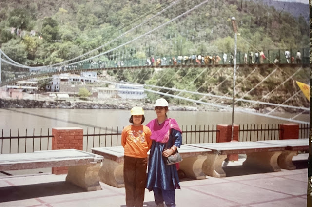
| At the The Ramjhoola at Rishikesh |
 |
| The Itinerary as planned in June 1997 |
The nostalgic memories of the trip that was undertaken in June 1997 are as fresh as if they happened yesterday . I have dug into my treasure trove of pictures to share some of these memories, so that, the readers can also get the feel of the place. I am also attaching the itinerary as I had planned, from my archives and though a bit mutiliated is still readable!The adventures to more destinations will continue in the next posts
PS: 1. All the pictures are mine
2. Route Map of Gangotri kind courtesy Google

surely a lot in 24 hours!
ReplyDeletethat itinerary pic - with TOD and TOA - how nice!
Thanks a lot Sujatha for that kind comment! Happy you liked
DeleteI'm sure those mountains and ravines are etched in your mind. These pictures are such treasures! :)
ReplyDeleteIndeed Divya! I do treaure these moments and am glad you liked to read this account
DeleteWell captured! On my wishlist!
ReplyDeleteMany thanks! Do visit when you can
ReplyDelete